 |
|
 |
 |
 |
 |
 |
 |
Barreal to Beaver Lake
|
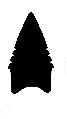
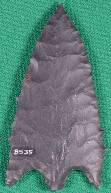
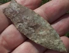
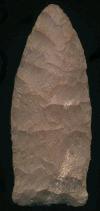
Barreal Associated Dates: 9000 – 7000 Y.B.P.
|
|||||||||||||||||||||||||||||||||||||||||||||||||||||||||||||||||||||||||||||||||||||||||||||||||||||||||||||||||||||||||||||||||||||||||||||||||||||||||||||||||||||||||||||
|
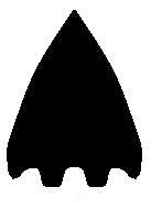
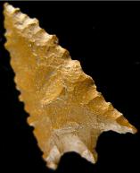
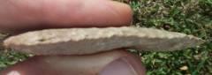
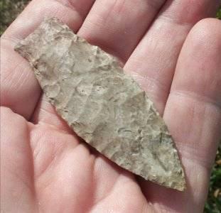
Basal Double Tang Associated Dates: 3500 – 2000 Y.B.P.
|
|||||||||||||||||||||||||||||||||||||||||||||||||||||||||||||||||||||||||||||||||||||||||||||||||||||||||||||||||||||||||||||||||||||||||||||||||||||||||||||||||||||||||||||
|
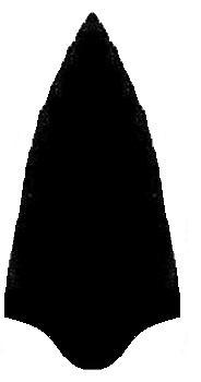
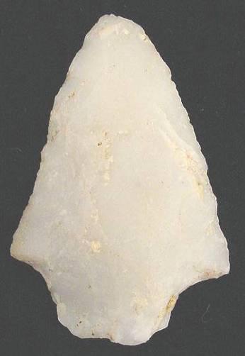
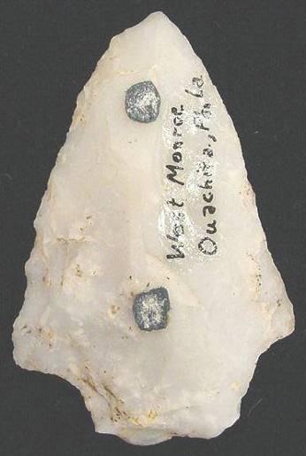
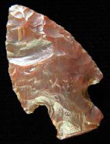
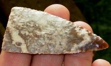
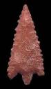
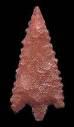
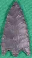
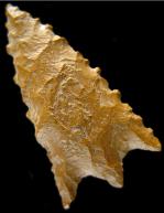
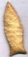
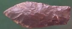
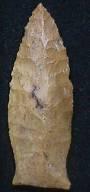
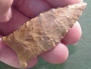
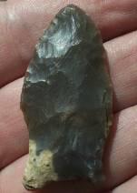
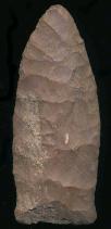
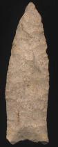
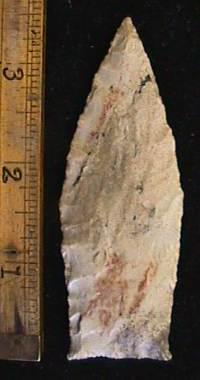
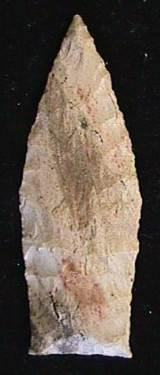
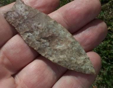
Bascom Associated Dates: 4500 – 3500 Y.B.P.
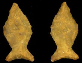
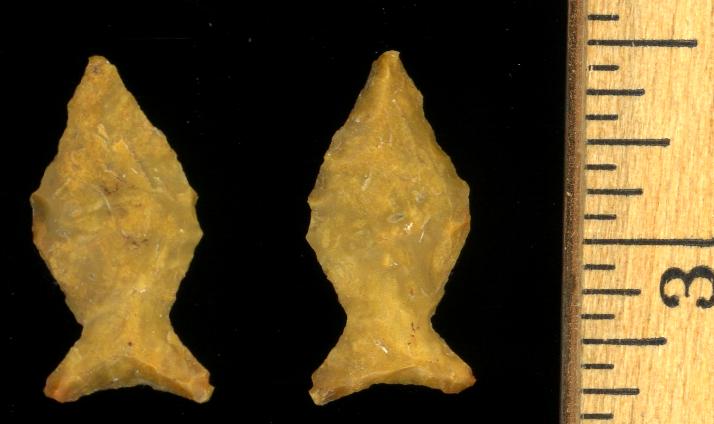
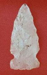
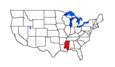
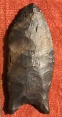
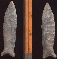
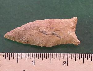
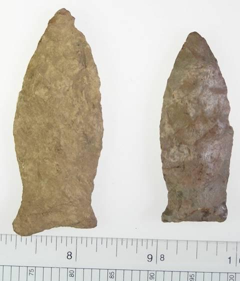
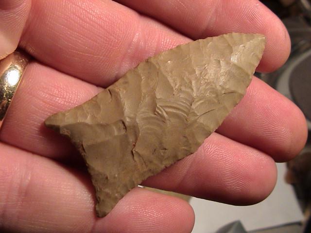
ABOVE: BASC01 AND BASC02: Bascom point; west Monroe, Ouachita Parish, Louisiana |
|||||||||||||||||||||||||||||||||||||||||||||||||||||||||||||||||||||||||||||||||||||||||||||||||||||||||||||||||||||||||||||||||||||||||||||||||||||||||||||||||||||||||||||
|
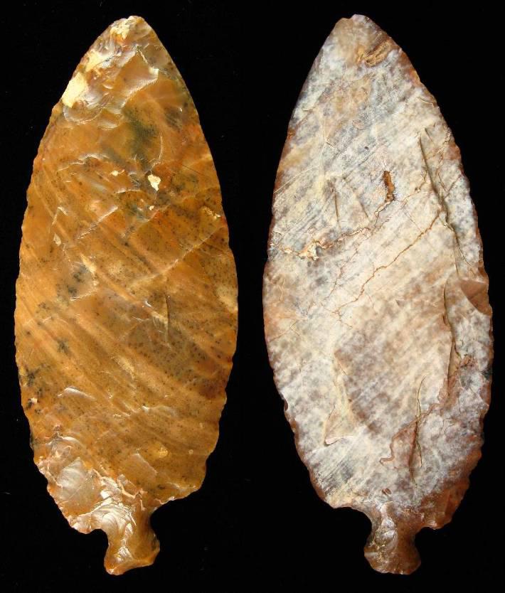
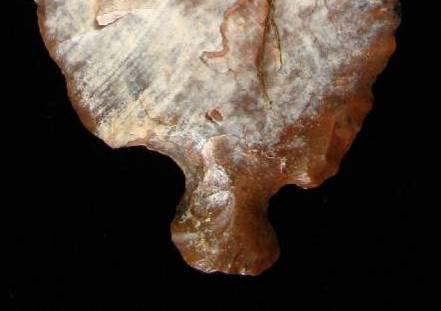
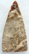
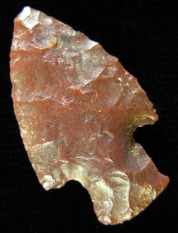
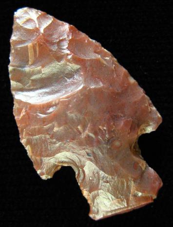
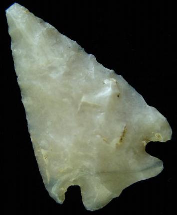
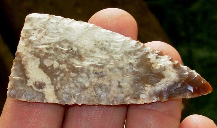
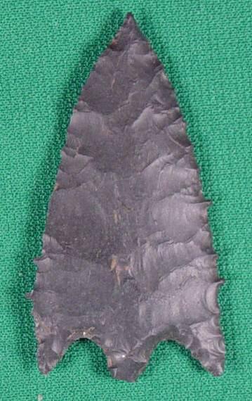
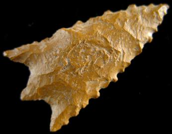
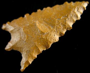
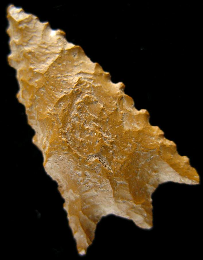
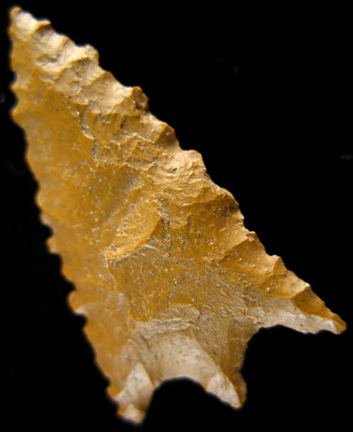
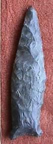
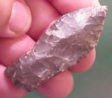
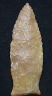
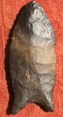
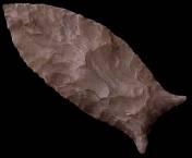
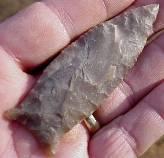
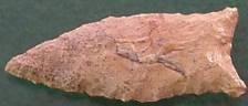
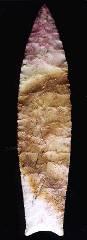
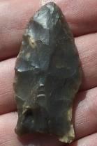
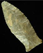
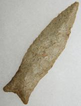
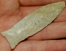
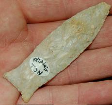
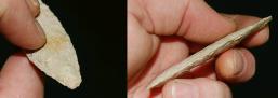
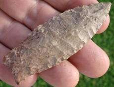
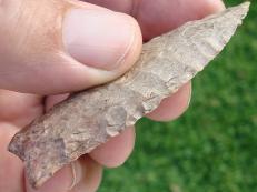
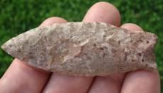
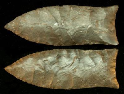
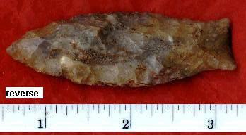
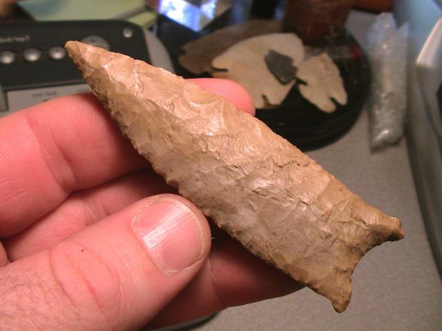
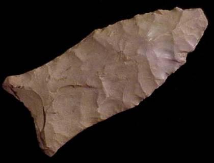
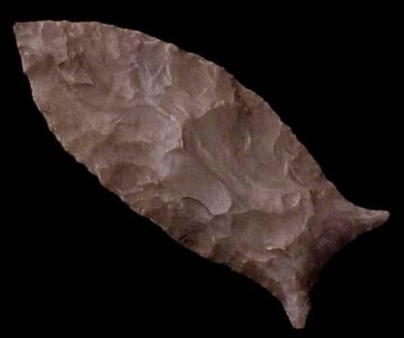
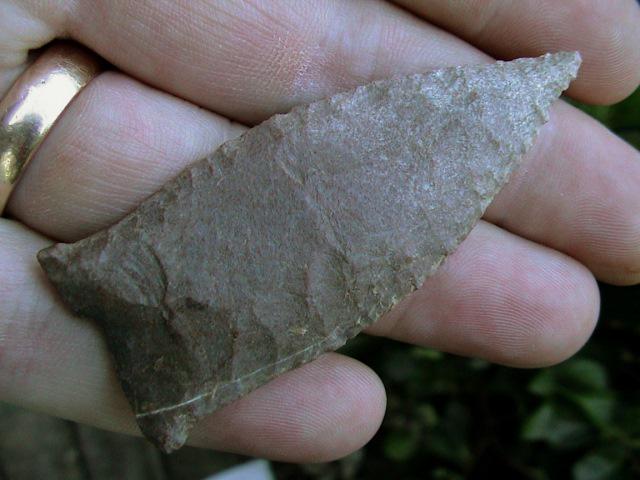
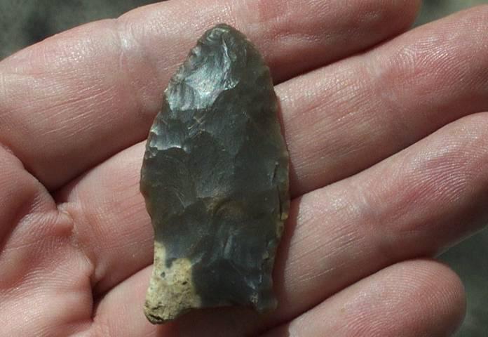
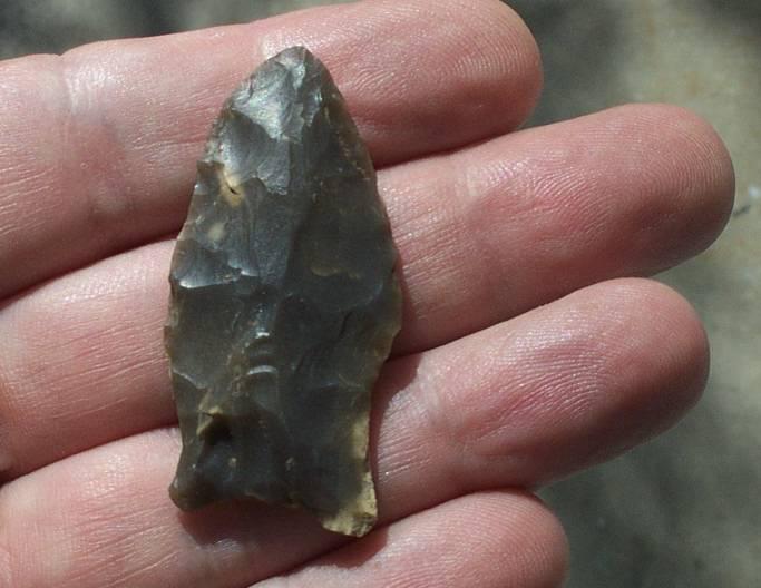
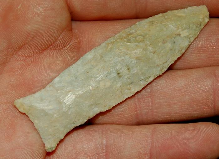
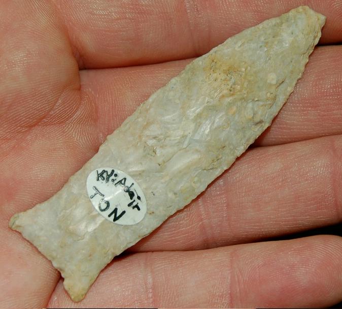
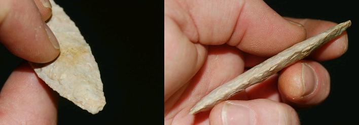
Base Tanged Knife Associated Dates: 4000 – 2000 Y.B.P
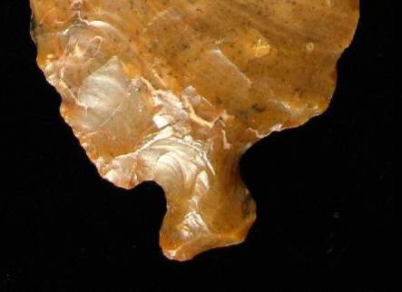
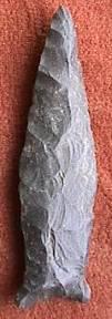
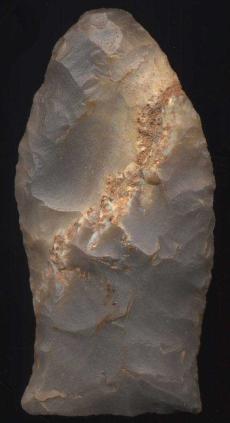
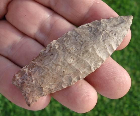
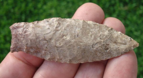
ABOVE: BASETANG07: a form of Base Tang knife; Fair Play, Colorado; Trout Creek chert; see basal enlargements in following two images. Source: Chris Merriam, Arrowheadsonline dot com
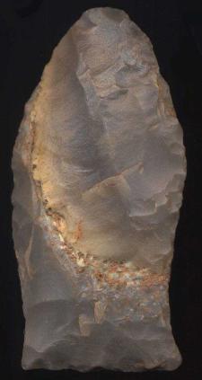
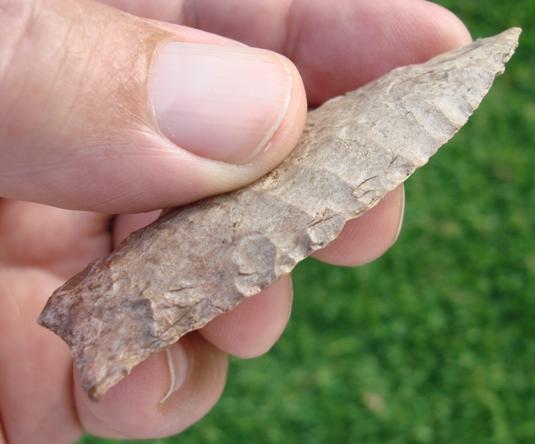
ABOVE: BASETANG08: second of three images of the Base Tang knife described in frame #07. Source: Chris Merriam, Arrowheadsonline dot com
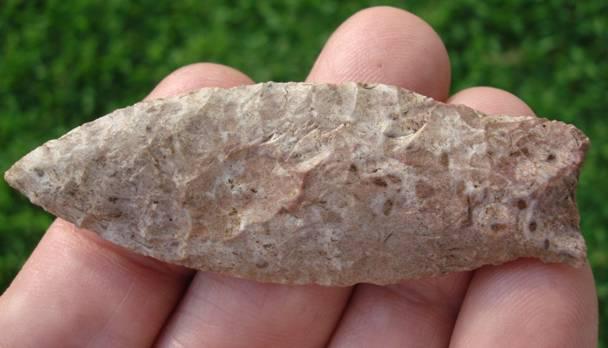
ABOVE: BASETANG09: third of three images of the Base Tang knife described in frame #07. Source: Chris Merriam, Arrowheadsonline dot com |
|||||||||||||||||||||||||||||||||||||||||||||||||||||||||||||||||||||||||||||||||||||||||||||||||||||||||||||||||||||||||||||||||||||||||||||||||||||||||||||||||||||||||||||
|
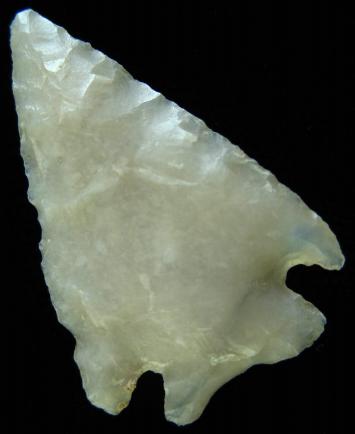
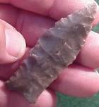
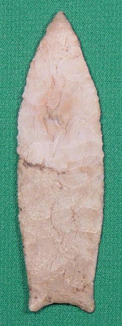
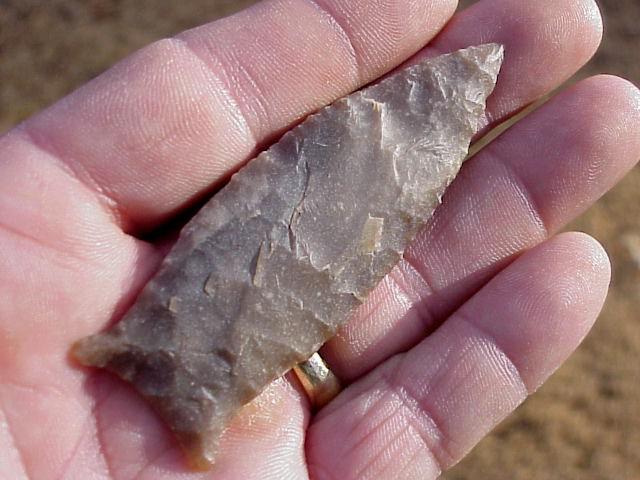
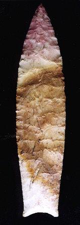
Basketmaker Associated Dates: 1500 – 1300 Y.B.P
BASKETMAKER POINT THUMBNAIL GALLERY (18 images: 9 source images/9 thumbnails)
ABOVE: BASKET01 AND BASKET02: Basketmaker point; location not stated; 1.13 inches (28.7mm); first of four views (enlargements follow). Source: Chris Merriam, Arrowheadsonline dot com
ABOVE: BASKET03: third of four views of Basketmaker point described above. Source: Chris Merriam, Arrowheadsonline dot com
ABOVE: BASKET04: fourth of four views of Basketmaker point described above. Source: Chris Merriam, Arrowheadsonline dot com
ABOVE: BASKET05 AND BASKET06: Basketmaker point; location not stated; 1.13 inches (28.7mm). Source: Chris Merriam, Arrowheadsonline dot com
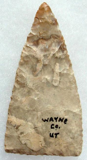
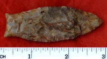
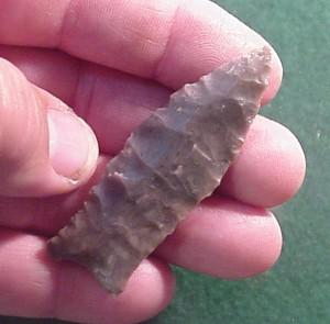
ABOVE: BASKET07 AND BASKET08: Basketmaker point, knife form; Wayne Co., Utah; 2.62 inches (66.5mm); first two of three views. Source: Tony Wright, Arrowheads dot com
ABOVE: BASKET09: third of three views of Basketmaker point, knife form, described above in frame #07. Source: Tony Wright, Arrowheads dot com |
|||||||||||||||||||||||||||||||||||||||||||||||||||||||||||||||||||||||||||||||||||||||||||||||||||||||||||||||||||||||||||||||||||||||||||||||||||||||||||||||||||||||||||||
|
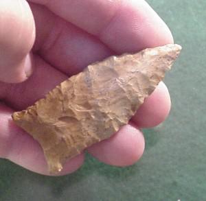
Basset Associated Dates: 800 – 400 Y.B.P.
ABOVE: BASS01: Basset point BASSET POINT THUMBNAIL GALLERY (18 images: 9 source images/9 thumbnails)
End of Basset Thumbnail Gallery - Complete
ABOVE, LEFT: BASS02: Basset point; Cass Co., Texas; 1.13 inches 28.7mm) ABOVE, RIGHT: BASS03: Basset point; Cass Co., Texas; 1.06 inches (26.9mm)
ABOVE: BASS04 AND BASS05: Basset point; Goldthwaite, Texas; 2.63 inches (65.75mm)
ABOVE: BASS06 AND BASS07: Basset point; Lafayette Co., Arkansas; 1.0 inch (25.4mm); first two of four views. Source: Chris Merriam, Arrowheadsonline dot com
ABOVE: BASS08: third of four views of Basset point described above in frame #06. Source: Chris Merriam, Arrowheadsonline dot com
ABOVE: BASS08: third of four views of Basset point described above in frame #06. Source: Chris Merriam, Arrowheadsonline dot com
ABOVE: BASS09: fourth of four views of Basset point described above in frame #06. Source: Chris Merriam, Arrowheadsonline dot com |
|||||||||||||||||||||||||||||||||||||||||||||||||||||||||||||||||||||||||||||||||||||||||||||||||||||||||||||||||||||||||||||||||||||||||||||||||||||||||||||||||||||||||||||
|
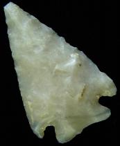
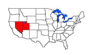
Bat Cave Associated Dates: 9000 – 8000 Y.B.P
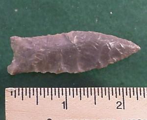
ABOVE: BATCAVE01 AND BATCAVE02: Bat Cave point; Pima Co., Arizona; 1.5 inches (38.1mm); obsidian |
|||||||||||||||||||||||||||||||||||||||||||||||||||||||||||||||||||||||||||||||||||||||||||||||||||||||||||||||||||||||||||||||||||||||||||||||||||||||||||||||||||||||||||||
|
Bay De Noc Side Notch Associated Dates: More Info Needed |
|||||||||||||||||||||||||||||||||||||||||||||||||||||||||||||||||||||||||||||||||||||||||||||||||||||||||||||||||||||||||||||||||||||||||||||||||||||||||||||||||||||||||||||
|
Bayogoula Associated Dates: 800 – 400 Y.B.P.
Bayogoula POINT THUMBNAIL GALLERY (18 images: 9 source images/9 thumbnails)
End of Bayogoula Thumbnail Gallery - Complete
ABOVE: BAYOG01: Bayogoula point (very rare); further details to follow; first of two views. Source: Chris Merriam, Arrowheadsonline dot com
ABOVE: BAYOG02: second of two views of Bayogoula point described above. Source: Chris Merriam, Arrowheadsonline dot com
ABOVE: BAYOG03: Bayogoula point (very rare); further details to follow. Source: Chris Merriam, Arrowheadsonline dot com |
|||||||||||||||||||||||||||||||||||||||||||||||||||||||||||||||||||||||||||||||||||||||||||||||||||||||||||||||||||||||||||||||||||||||||||||||||||||||||||||||||||||||||||||
|
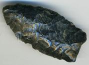
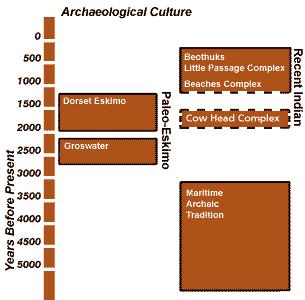
Beaches Complex Associated Dates: 1200 - 1000 Y.B.P. (approximate) General Description: The Beaches Complex of Newfoundland, Canada, is believed to be part of a continuum of the same people. The sequence may therefore be, from earliest to latest: Beaches Complex, Little Passage Complex, Beothuk (see illustration below for associated dates).
ABOVE: BEACH01: Position of the Beaches Complex relative to other Recent Indian peoples in Newfoundland. Source: Illustration by Duleepa Wijayawardhana based upon data supplied by Dr. Ralph Pastore, Memorial University of Newfoundland, St. John's, Newfoundland cited on http://www.heritage.nf.ca/aboriginal/recent.html The primary difference between the complexes can be seen in their respective tool kits. Working backwards: The Beothuk had the same tool kit as the Little Passage but added metals after European contact; the Little Passage Complex differs from the Beaches in that the latter relied on a different lithic base: “Instead of the fine-grained blue-green chert favoured by the Little Passage toolmakers, the Beaches people preferred coarser grained black and brown cherts and a relatively common rock called rhyolite. Rhyolite is much coarser-grained than chert and it cannot be worked as carefully.” (Source: Memorial University of Newfoundland http://www.heritage.nf.ca/aboriginal/recent.html) The Beaches complex is named for the Beaches Site, Bonavista Bay, Newfoundland, Canada. Beaches complex projectile points are larger than those of the succeeding Little Passage Complex and it is surmised that this is not due solely to their choices of lithic materials. Rather, it is possibly because the Beaches Complex is pre-bow-and-arrow and the Little Passage Complex reflects acquisition of the new weapons technology.
ABOVE, LEFT: BEACH02: Beaches Complex artifacts; Boyd’s Cove, Notre Dame Bay, Newfoundland, Canada. Source: Dr. Ralph Pastore, Memorial University of Newfoundland http://www.heritage.nf.ca/aboriginal/recent.html |
|||||||||||||||||||||||||||||||||||||||||||||||||||||||||||||||||||||||||||||||||||||||||||||||||||||||||||||||||||||||||||||||||||||||||||||||||||||||||||||||||||||||||||||
|
Beachum Associated Dates: 8000 – 7500 Y.B.P.
|
|||||||||||||||||||||||||||||||||||||||||||||||||||||||||||||||||||||||||||||||||||||||||||||||||||||||||||||||||||||||||||||||||||||||||||||||||||||||||||||||||||||||||||||
|
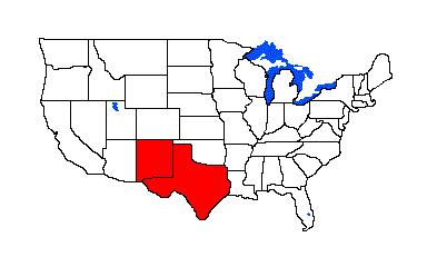
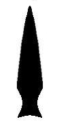
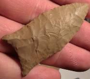
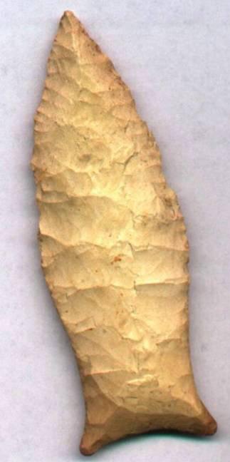
Beacon Island 3500 - 2200 Y.B.P. - Late Archaic - Woodland Also See: Big Slough, Elk River, Flint Creek, Palmillas Location: Southeastern United States Morphology:Stemmed
General Description: The Beacon Island is a small to large sized trianguloid bladed, bulbous stemmed dart or spear point. The shoulders on the point are usually very well defined and can be barbed. The stem is always bulbous and thin. The blade's general outline is triangular. The blade edges are unbeveled and often faintly serrated. The blade's proximal end has horizontal, slightly tapered or slightly inversely tapered barbs. Numerous percussion flake scars remain on both blade faces. Flint Creek style of flaking was usually employed to finish the blade edges and to produce faint biface serrations. The Beacon Island is very similar to the Palmillas type in Texas. The blade has been recovered from numerous sites in association with Flint Creek and other Early Woodland artifacts. The Beacon Island point ranges in size from 32 mm to 121 mm in length with the average being 58 mm. The width ranges from 26 mm to 38 mm with the average being 31 mm. The stem can range from 14 mm to 17 mm in length with the average being 15 mm. The stem width ranges from 11 mm to 20 mm wide with the average being 18 mm. The Beacon Island type was named by Ralph H. Allen and David C. Hulse for examples which were recovered from Beacon Island near Florence, Alabama.
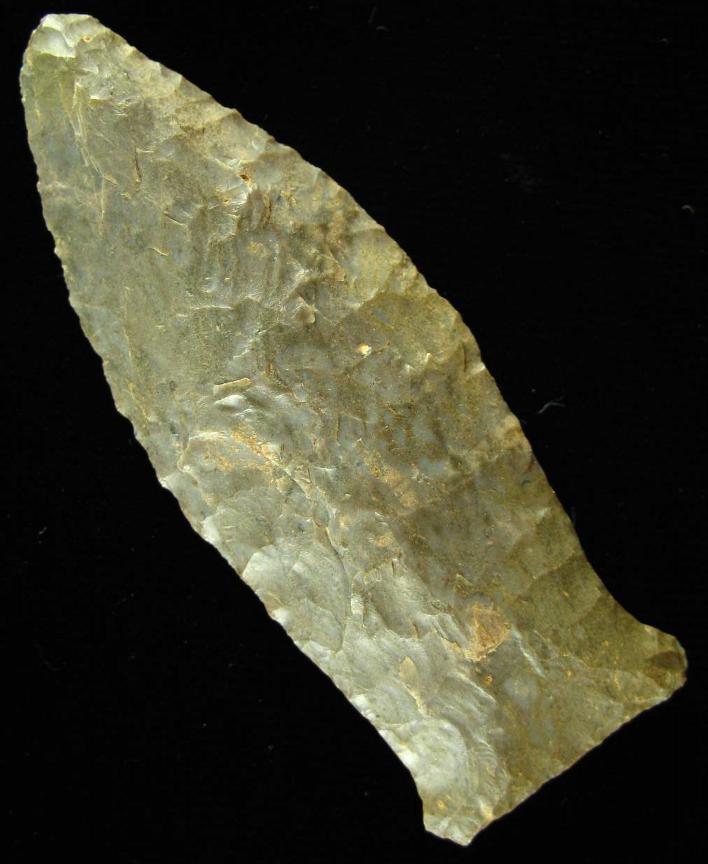
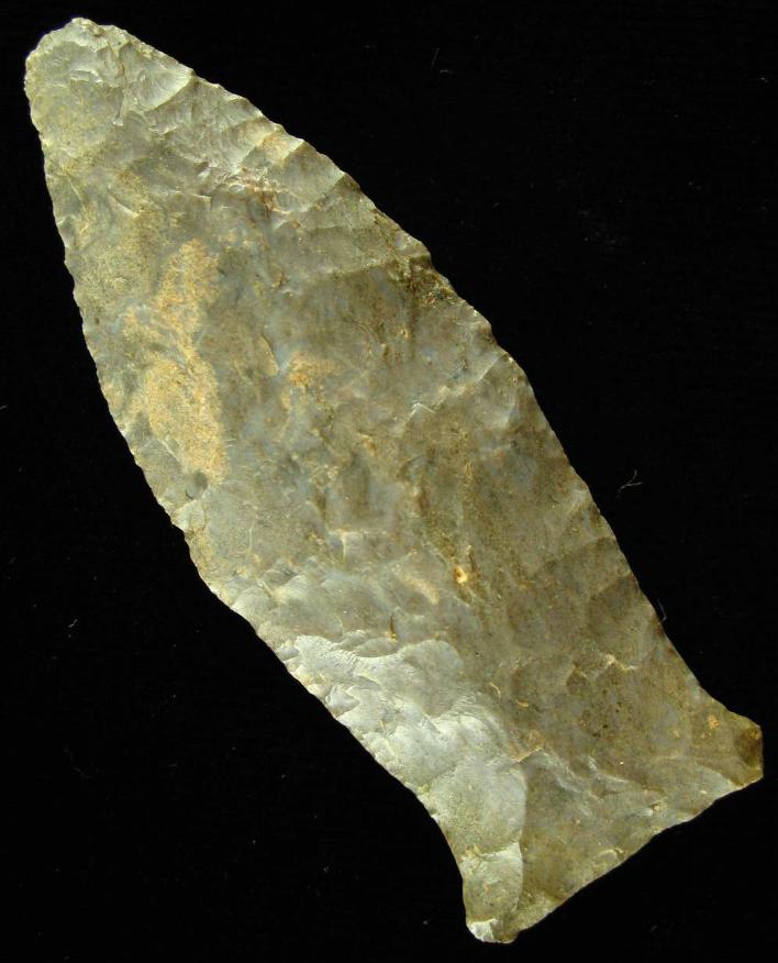
ABOVE: BEACON01: Beacon Island point; see below for details About the Point Above: The point pictured above is a large Beacon Island point made from a very highly patinated, satin, brownish tree bark colored flint with tanish undertones. The point measures 90 mm in length, 33 mm at the widest point (at mid blade) and is 9 mm thick (at mid blade) along the blade with the the base thinning to 4 mm. The stem is 14 mm wide at the notches and is 14 mm long. The base does not appear to be ground. The blade edges are somewhat sharp and have well worn down very fine serrations. The blade has a median ridge on one side (photgraphed) and is relatively flat on the other blade face. This point was a surface find from the bed of one of the small creeks near the town of Ramar, Tennessee. (TEXT SOURCE: Art Gumbus, Lithic-Net) BEACON ISLAND POINT THUMBNAIL GALLERY (32 images: 16 source images/16 thumbnails)
End of Beacon Island Thumbnail Gallery - Complete
ABOVE: BEACON02: Beacon Island point; Lauderdale Co., Alabama; 3.56 inches (89mm)
ABOVE: BEACON03: Beacon Island point; Shelbyville, Indiana; 2.75 inches (68.75mm); first of two views
ABOVE: BEACON04: second of two views of Beacon Island point described above
ABOVE: BEACON05: Beacon Island point; Lauderdale Co., Alabama; 2.25 inches (56.25mm)
ABOVE: BEACON06: Beacon Island point; 4.0 inches (100mm)
ABOVE, L-R: BEACON07 AND BEACON08: Beacon Island point; Benton Co., Tennessee; 2.0 inches (50mm)
ABOVE, L-R: BEACON09 AND BEACON10: Beacon Island point; Meade Co., Kentucky; 3.5 inches (87.5mm)
ABOVE: BEACON11: Beacon Island point; Hardin Co., Tennessee; 3.75 inches (93.75mm)
ABOVE, LEFT: BEACON12: Beacon Island point; Fort Payne chert; location not provided ABOVE, RIGHT: BEACON13: Beacon Island point; Tennessee River Basin; 4.25 inches (106.25mm); Fort Payne chert
ABOVE, RIGHT: BEACON14: Beacon Island point; no location; 3.5 inches (88.9mm). Source: Arrowheadhunters dot com
ABOVE: BEACON15: Beacon Island point; no location. Source: Arrowheadhunters dot com, personal collection
ABOVE: BEACON16: Beacon Island point; Franklin Co., Alabama; 3.75 inches (95.2mm)
End of Beacon Island Gallery - Complete Bear River Associated Dates: 1300 – 400 Y.B.P.
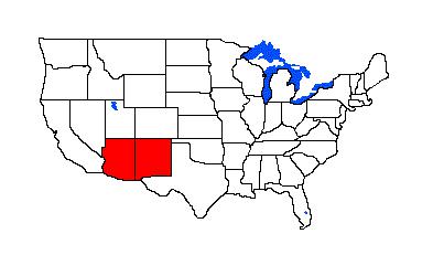
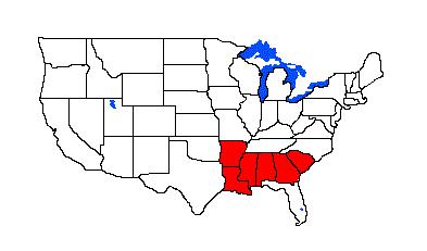
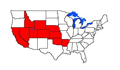
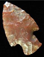
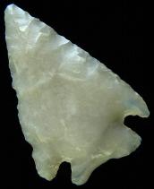
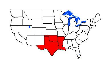
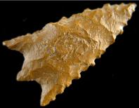
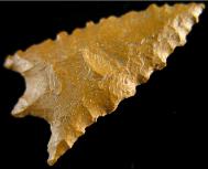
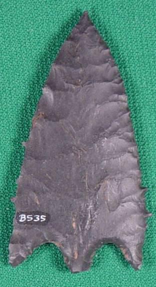
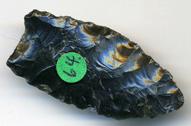
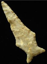
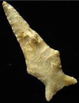
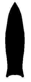
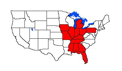
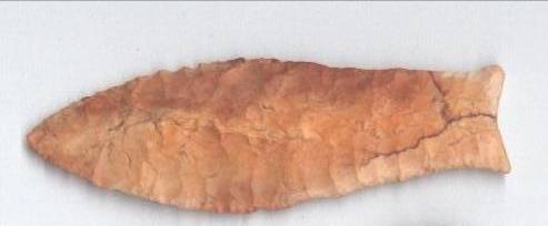
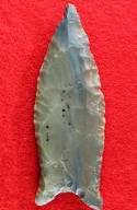
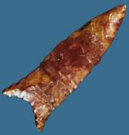
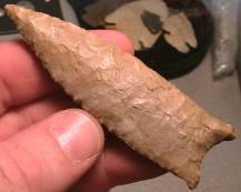
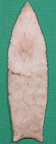
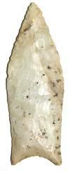
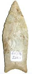
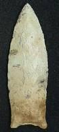
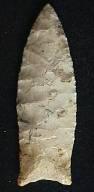
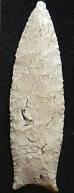
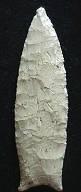
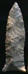
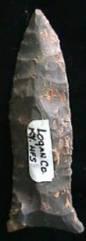
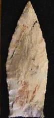
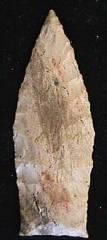
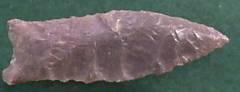
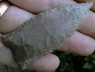
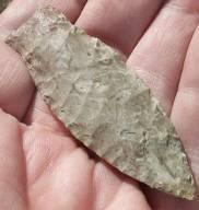
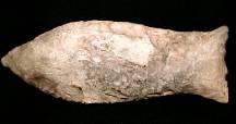
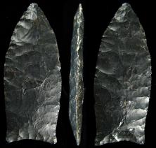
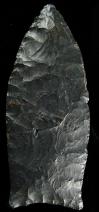
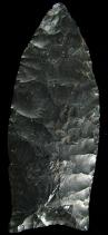
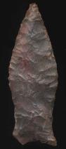
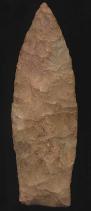
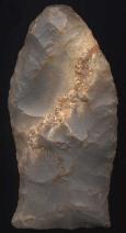
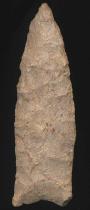
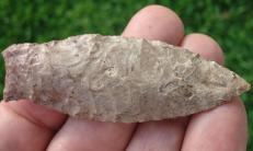
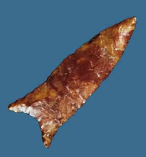
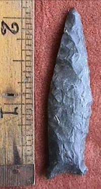
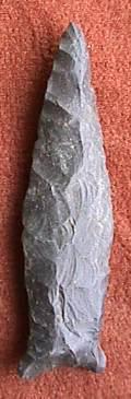
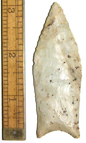
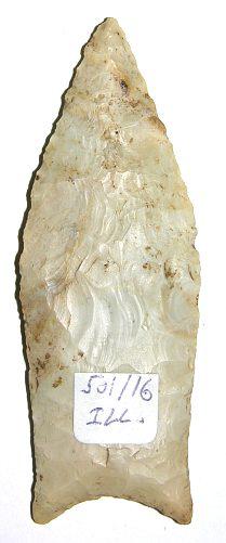
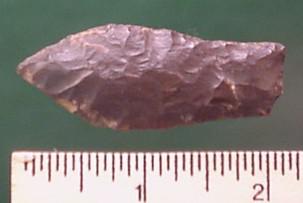
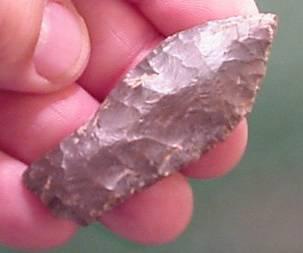
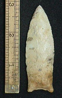
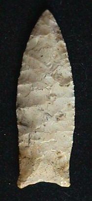
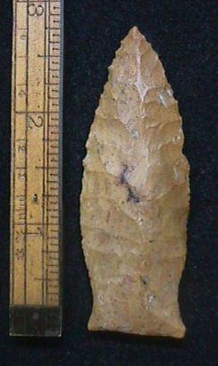
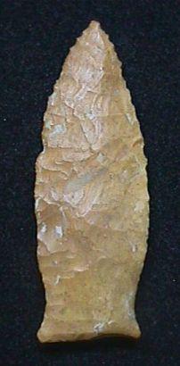
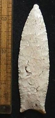
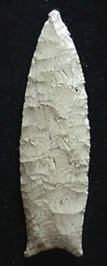
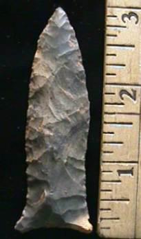
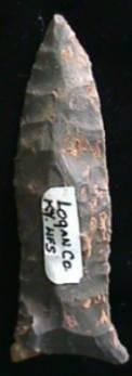
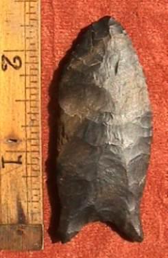
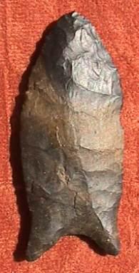
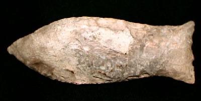
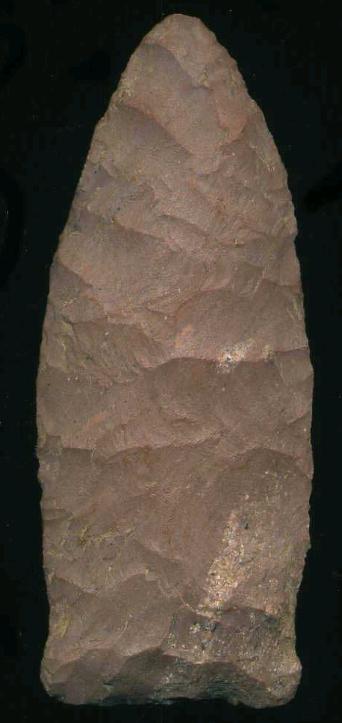
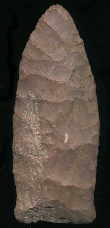
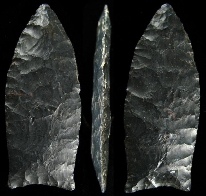
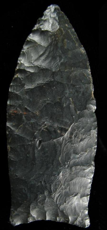
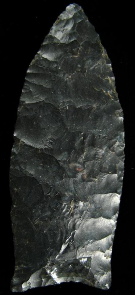
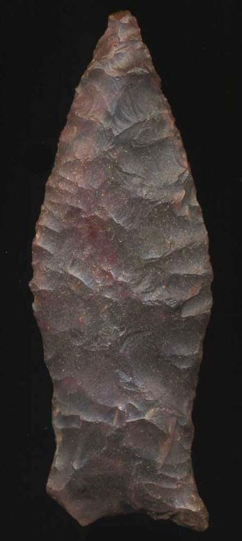
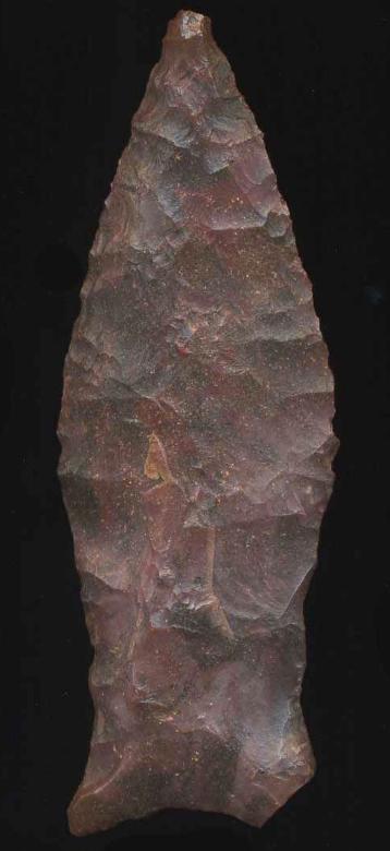
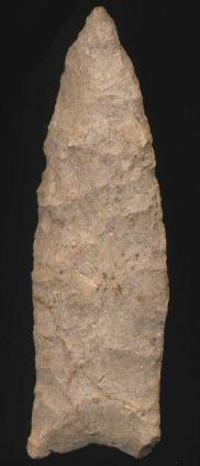
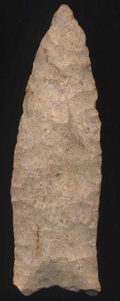
Beaver Lake Associated Dates: 11,000 - 8500 Y.B.P. - Paleo - Early Archaic Also See: Arkabutla, Barber, Bat Cave, Candy Creek, Cumberland, Golondrina, Midland, Pike County, Quad, Simpson, Suwannee Location: Midwestern to Eastern United States and Florida Morphology: Auriculate
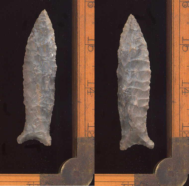
General Description: The Beaver Lake projectile point is a medium- to large-sized, lanceolate, unfluted blade with flaring basal ears or auricles on the stem base. The basal edges and stem sides are typically ground smooth and the base is concave and is rarely straight. The basal edge often has short basal thinning flakes removed. The blade edges are recurved and constrict towards the base to form an extended stem or hafting area. The Beaver Lake type is comparable to the Cumberland point type but the Beaver Lake totally lacks fluting and specimens typically show only moderate basal thinning. At one time, Beaver Lake points were called Unfluted Cumberland. Beaver Lake points are usually much thinner in cross section that Cumberland points and can have broader width proportions. The Beaver Lake's cross section is typically biconvex, sometimes with a median ridge exhibited on one or both blade faces. The Beaver Lake points were knapped with a combination of controlled percussion and pressure flaking techniques. They have a late Paleo-Indian affiliation and are considered part of the Dalton Cluster of projectile points. Beaver Lake points are rare but do occur throughout the Tennessee River Valley in northern Alabama, northeastern Mississippi, Tennessee, Kentucky and Missouri. They can spo radically occur over much of the South since Beaver Lake points have been identified from northern Florida, South Carolina, North Carolina and Georgia. A few points have been recovered in the Ohio Valley from Illinois, southern Indiana, West Virginia and Ohio.The size of Beaver Lake points can range from 47 mm to 86 mm in length. The average size is 64 mm in length, with a typical width of 24 mm. Thickness averages 8 mm. The type has been called the Unfluted Cumberland in some papers. The point was named in 1962 by David L. DeJarnette, James W. Cambron, David C. Hulse and Edward B. Kurjack for examples that were recovered from the Stanfield-Whorley Bluff Shelter, Colbert County, Alabama. It was named for the Beaver Lake area of Limestone County, Alabama.
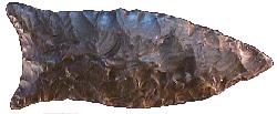
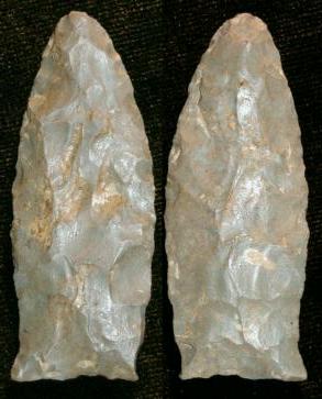
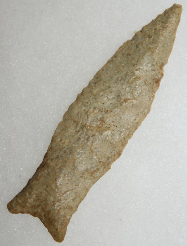
ABOVE: BEAVRLK01: Beaver Lake point; see details below About the Point Above: The large point pictured at the top left of this page, was found in Meade County, Kentucky. The point is made from a glossy dark chocolate colored flint that has light caramel colored flint inclusions on the outer edges of the blade, especially near the tip. Overall, the point measures 73 mm in length, is 28 mm wide (across the auricles) and is only 6 mm thick in mid blade. The concavity of the base is 4 mm deep. The base is ground as are the ears and blade edges running 21 mm up from the ears of the base. The hafting area is 24 mm wide and the width across the widest part of the blade is 26 mm. Catalog Number 189E-250-L
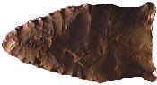
ABOVE: BEAVRLK02: Beaver Lake point; see details below About the Point Above: The small point pictured above was found outside the town of New Hope, Madison County, Alabama in a creek bank. The point is made from a highly patinated light chocolate colored flint. Overall, the point measures 46 mm in length, is 23 mm wide (across the auricles) and is 7 mm thick in mid blade. The concavi
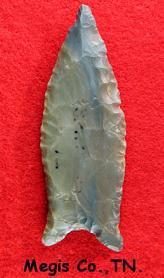
ABOVE: BEAVRLK03: Beaver Lake point; no other details BEAVER LAKE POINT THUMBNAIL GALLERY (142 images: 71 source images/71 thumbnails) End of Beaver Lake Thumbnail Gallery - Complete ABOVE: BEAVRLK04: Beaver Lake point; Hardin Creek, Tennessee; 3.38 inches (84.5mm) ABOVE: BEAVRLK05: Beaver Lake point; Hardin, Tennessee; 2.93 inches (73.25mm); described as dark brown Buffalo chert ABOVE, L-R: BEAVRLK06 AND BEAVRLK07: Beaver Lake point; from Pulaski Co., Kentucky ABOVE, LEFT: BEAVRLK08: Megis Co., Tennessee; no size given ABOVE: BEAVRLK10: Beaver Lake point; Kentucky; 2.5 inches (63.5mm); Fort Payne chert. Source: Earthworksartifacts.com ABOVE: BEAVRLK11: Beaver Lake point; no other details provided ABOVE, LEFT: BEAVRLK12: Beaver Lake point; Ohio; 3.8 inches (95mm) ABOVE: BEAVRLK15 and BEAVRLK16: Beaver Lake point; Illinois; 3.0 inches (75mm) ABOVE: BEAVRLK17 AND BEAVRLK18: Beaver Lake point; Simpson Co., Kentucky; 2.19 inches (54.75mm) ABOVE, L-R: BEAVRLK19 AND BEAVRLK20: Beaver Lake point; Stoddard Co., Missouri; 2.88 inches (72mm) ABOVE: BEAVRLK21 AND BEAVRLK22: Beaver Lake point; Butler Co., Missouri; 2.75 inches (68.75mm) ABOVE: BEAVRLK23 AND BEAVRLK24: Beaver Lake point; Pike Co., Illinois; 3.38 inches (84.5mm) ABOVE: BEAVRLK27 AND BEAVRLK28: Beaver Lake point; Tennessee; 3.5 inches (87.5mm) ABOVE: BEAVRLK29 AND BEAVRLK30: Despite appearances, this was papered by Perino as a definite Beaver Lake point. Diagnostically, this really has an intriguing transitional-type look to it. Hardin Co., Tennessee; 3.38 inches (84.5mm) ABOVE: BEAVRLK31: Beaver Lake point; Perry Co., Tennessee; 2.06 inches (51.5mm) ABOVE: BEAVRLK32: Beaver Lake point; Smith Co., Tennessee; 2.31 inches (58mm) ABOVE: BEAVRLK33: Beaver Lake point; Pettis Co., Missouri; 3.25 inches (81.25mm); Mozarkite chert ABOVE, L-R: BEAVRLK34 AND BEAVRLK35: Beaver Lake point; Green Co., Kentucky; 2.38 inches (59.5mm) ABOVE, L-R: BEAVRLK36 AND BEAVERLK37: Beaver Lake point; Edmonson Co., Kentucky; 2.31 inches (57.75mm) ABOVE: BEAVRLK38: Beaver Lake point; no other details ABOVE, LEFT: BEAVRLK39: Beaver Lake points; Tennessee ABOVE, FAR RIGHT: BEAVRLK40: Beaver Lake point; Missouri; no other details ABOVE: BEAVRLK41: Beaver Lake point; Greene Co., Kentucky; 2.63 inches (65.75mm) ABOVE: BEAVRLK42 AND BEAVRLK43: Beaver Lake point; first two of three images of this point from Kentucky; 2.81 inches (70.25mm) ABOVE: BEAVRLK45: Beaver Lake point from Monroe Co., Kentucky; 2.0 inches (50mm); first of two images ABOVE: BEAVRLK46: second of two images of the Beaver Lake point above ABOVE: BEAVRLK47: Beaver Lake point; Georgia; 3.13 inches (78.25mm); Coast Plains chert ABOVE: BEAVRLK48: Beaver Lake point; Tennessee/Kentucky line, Montgomery Co., Tennessee; 2.38 inches (59.5mm) ABOVE: BEAVRLK49: Beaver Lake point; Tennessee River, Lawrence Co., Tennessee; 2.88 inches (72mm); first of two images. Source: Chris Merriam, Arrowheadsonline dot com ABOVE: BEAVRLK50: second of two views of Beaver Lake point described above. Source: Chris Merriam, Arrowheadsonline dot com ABOVE: BEAVRLK51: Beaver Lake point; Mercer Co., Kentucky; 3.75 inches (95.2mm) ABOVE: BEAVRLK52 AND BEAVRLK53: Beaver Lake point; Kentucky 2.43 inches (61.7mm). Source: Penbrandt dot com ABOVE: BEAVRLK66 AND BEAVRLK67: Beaver Lake point; Shelby Co., Kentucky; 2.38 inches (60.4mm); Harrodsburg chert. Source: Penbrandt dot comABOVE: BEAVRLK54: Beaver Lake point; Adair Co., Kentucky; 3.13 inches (79.5mm); first of three views ABOVE: BEAVRLK55: second of three views of Beaver Lake point described above in frame #54 ABOVE: BEAVRLK56: third of three views of Beaver Lake point described above in frame #54 ABOVE: BEAVRLK57: Beaver Lake point; Delaware Co., Ohio; 2.25 inches (57.1mm); Coshocton flint; first of three views. Source: Chris Merriam, Arrowheadsonline dot com ABOVE: BEAVRLK58: second of three views of Beaver Lake point described above. Source: Chris Merriam, Arrowheadsonline dot com ABOVE: BEAVRLK59: third of three views of Beaver Lake point described above. Source: Chris Merriam, Arrowheadsonline dot com ABOVE: BEAVRLK60 AND BEAVRLK61: Beaver Lake point; Grayson Co., Kentucky; 2.25 inches (57.1mm); Sonora chert. Source: Penbrandt dot com ABOVE: BEAVRLK62 and BEAVRLK63: Beaver Lake point; Shelby Co., Kentucky; 2.875 inches (73mm); Brassfield chert. Source: Penbrandt dot com ABOVE: BEAVRLK64 AND BEAVRLK65: Beaver Lake point; Logan Co., Kentucky; 1.8 inches (45.7mm); first of two views; hornstone. Source: Penbrandt dot com ABOVE: BEAVRLK66 AND BEAVRLK67: Beaver Lake point; Shelby Co., Kentucky; 2.38 inches (60.4mm); Harrodsburg chert. Source: Penbrandt dot com ABOVE: BEAVRLK68: Beaver Lake point; Kentucky; 2.8 inches (71.1mm); first of four views. Source: Roadrunnerartifacts dot com ABOVE: BEAVRLK69: second of four views of Beaver Lake point describe above in frame #68. Source: Roadrunnerartifacts dot com ABOVE: BEAVRLK70: third of four views of Beaver Lake point describe above in frame #68. Source: Roadrunnerartifacts dot com ABOVE: BEAVRLK71: fourth of four views of Beaver Lake point describe above in frame #68. Source: Roadrunnerartifacts dot com End of Beaver Lake Gallery - Complete End of Barreal to Beaver Lake - Complete |
|
©2010 J Keffer |